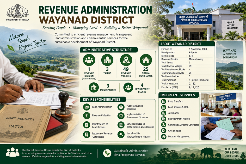
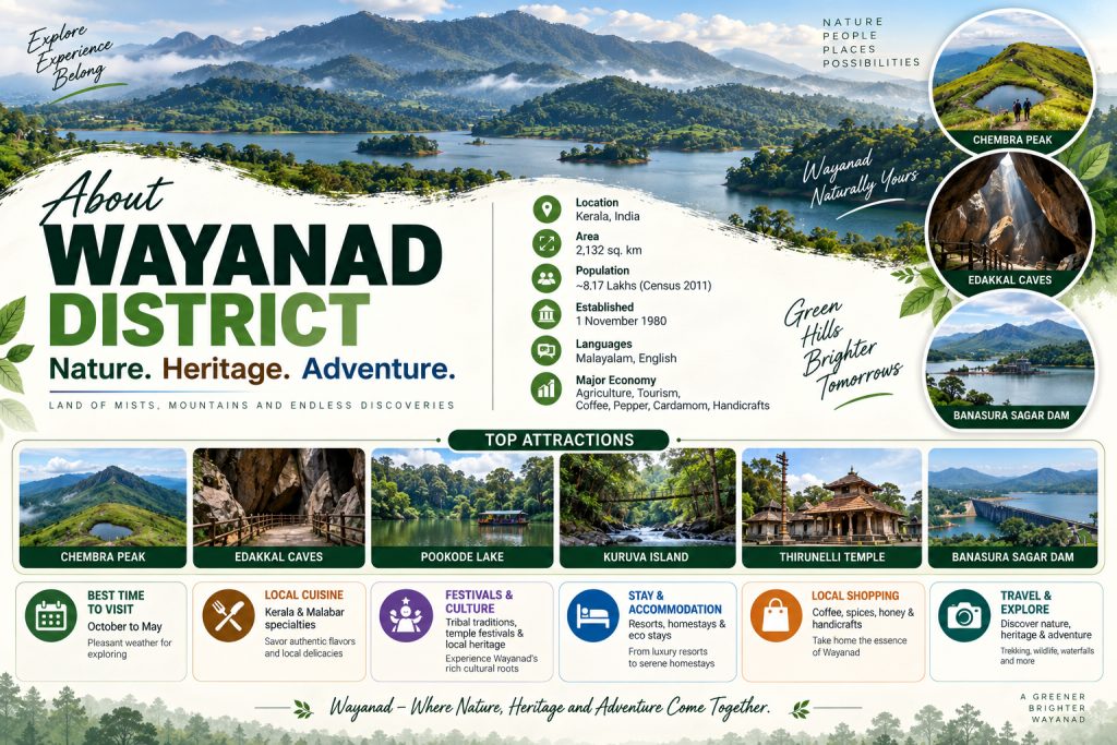
About Wayanad District
Wayanad District is one of the prominent districts of Kerala, known for its rich natural beauty, misty mountains, agricultural importance, tribal heritage and cultural diversity. The district was officially formed on 1 November 1980 and features beautiful Western Ghats landscapes along with dense forests, valleys, waterfalls and wildlife. Agriculture is a major economic activity, with coffee, pepper, cardamom, tea and rice being important crops, supported by the Banasura Sagar and Karapuzha dams. Wayanad is also home to historic temples, cultural landmarks and scenic attractions such as Edakkal Caves, Thirunelli Temple, Chembra Peak, Soochipara Waterfalls and Kuruva Island. With good connectivity, natural beauty, historical significance and developing infrastructure, Wayanad represents a harmonious blend of nature, heritage, culture and growth, contributing to the tourism, agriculture, trade and overall development of Kerala.
Ancient and Early History
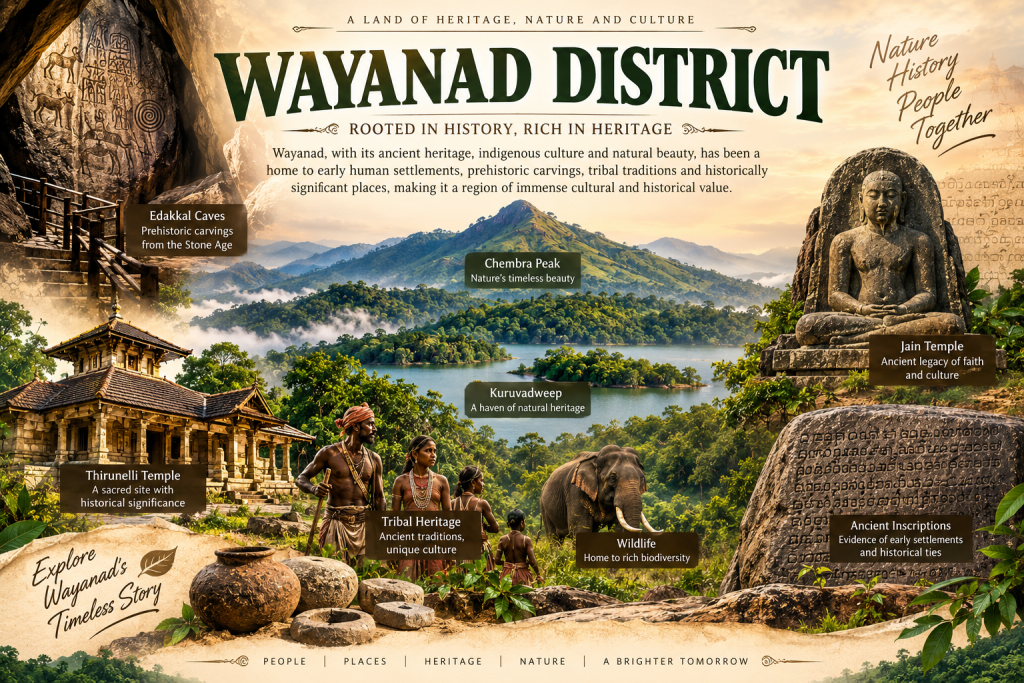
Wayanad District has a rich and ancient historical heritage, with roots extending back to prehistoric periods and early human settlements. The region witnessed the influence of prominent South Indian dynasties and rulers, contributing to its cultural, religious and social development. Areas such as Ambalavayal, Mananthavady and Thirunelli preserve ancient temples, archaeological remains and historical landmarks that reflect the region’s diverse traditions. The Edakkal Caves at Ambalavayal, famous for their prehistoric rock engravings, are an important archaeological landmark, while the Thirunelli Temple showcases Wayanad’s long-standing religious heritage. The indigenous communities, including the Paniya, Kurichiya and Kattunayakan, have preserved distinctive customs, traditions and traditional knowledge through generations. The ancient settlements, archaeological sites, temples and tribal heritage further reflect the district’s long-standing cultural identity, making Wayanad an important part of Kerala’s ancient history and heritage.
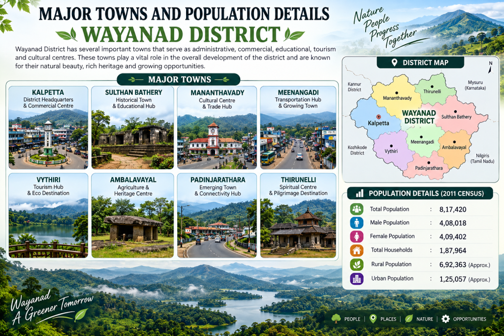
Major Towns and Population Details
Wayanad District has several important towns that serve as administrative, commercial, educational, agricultural and tourism centres. Kalpetta, the district headquarters, is a major centre for administration, trade, education and tourism, while Mananthavady is known for its historical importance, tribal heritage and agricultural activities. Sulthan Bathery is an important commercial and transportation hub, connecting Wayanad with neighbouring districts and Karnataka. Vythiri, Meppadi, Panamaram and Ambalavayal also contribute to tourism, agriculture and local commerce. According to the 2011 Census, Wayanad had a population of around 8.17 lakh, with a significant majority living in rural areas and depending on agriculture, tourism, trade, small-scale industries and services. These towns and surrounding villages play an important role in the district’s social, cultural and economic development. These urban centres provide essential facilities including hospitals, schools, colleges, banks, markets, government offices, transport services and recreational spaces. Their surrounding rural areas are closely linked through roads and public transportation, supporting the movement of agricultural products, workers and visitors. Together, these towns strengthen Wayanad’s regional connectivity and balanced development.
Statistical Profile of Wayanad District
AREA
≈ 2,132 sq. km
Wayanad is a scenic district spread across vast agricultural lands, heritage sites, forests, and beautiful hill landscapes.
POPULATION
≈ 8.2 Lakhs
A vibrant district with a diverse population, known for its strong cultural roots, tribal heritage, and agricultural economy.
LANGUAGE
Malayalam & English
Malayalam is the primary language spoken in Wayanad, while English and other regional languages are also commonly used.
ECONOMIC BASE
Agriculture
Agriculture forms the backbone of Wayanad's economy, supported by tourism, plantations, spices, and other local industries.
Economy of Wayanad District
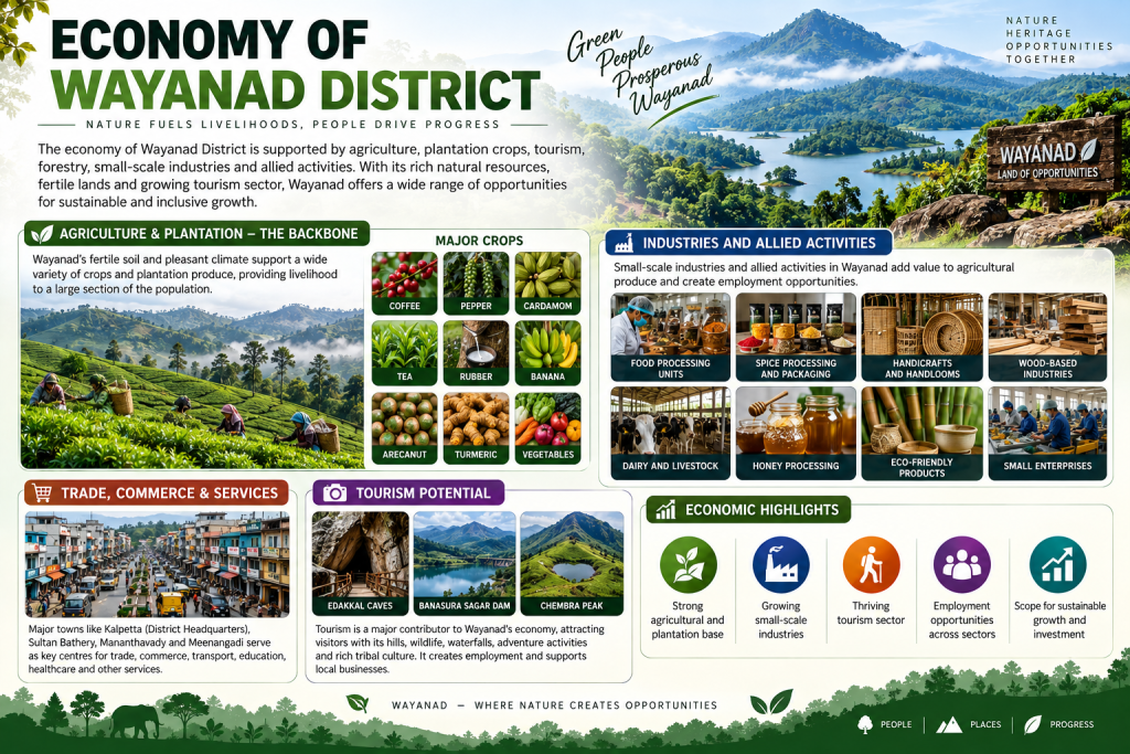
The economy of Wayanad District is primarily driven by agriculture, plantations, tourism, trade, small-scale industries and allied activities. The district’s fertile highland areas support major crops such as coffee, pepper, cardamom, tea, rice, ginger, turmeric and various horticultural crops, while agriculture remains an important source of livelihood. Wayanad is also known for coffee and spice plantations, dairy farming, livestock rearing, honey production, handicrafts and agricultural processing units, which provide employment and strengthen the rural economy. Towns such as Kalpetta, Mananthavady, Sulthan Bathery, Vythiri and Ambalavayal serve as important centres for trade, commerce and services. Tourism around the Western Ghats, waterfalls, wildlife sanctuaries, lakes, caves and heritage sites also supports local businesses. With its strong agricultural base, growing tourism sector, improving infrastructure and expanding commercial activities, Wayanad continues to develop as an important economic region of Kerala.
Geography and Natural Features
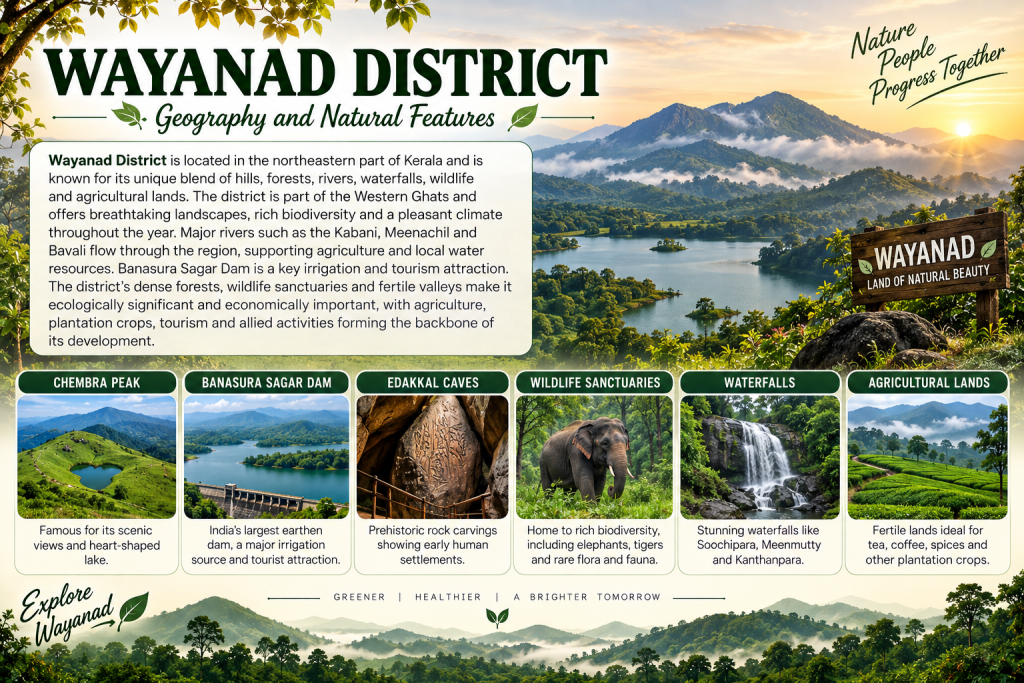
Wayanad District is located in the northeastern part of Kerala and is characterized by a diverse landscape of mountains, forests, valleys, rivers, waterfalls and agricultural lands. The Western Ghats form an important geographical feature of the district, offering scenic landscapes, dense vegetation and rich biodiversity. The district is drained by important rivers and streams, including the Kabini and its tributaries, which support agriculture and local water resources. The Banasura Sagar Dam and Karapuzha Dam are significant irrigation and water-management structures. The eastern and central parts of the district consist largely of fertile valleys and highlands suitable for agriculture, while the mountainous regions have forest ecosystems and diverse wildlife. Chembra Peak, the highest peak in Wayanad, is an important natural landmark, while Pookode Lake, Kuruva Island and the numerous waterfalls add to the district’s scenic beauty. The forests provide habitat for elephants, deer, wild boars, birds and other wildlife, forming an important part of the Western Ghats ecosystem.
Administrative Divisions
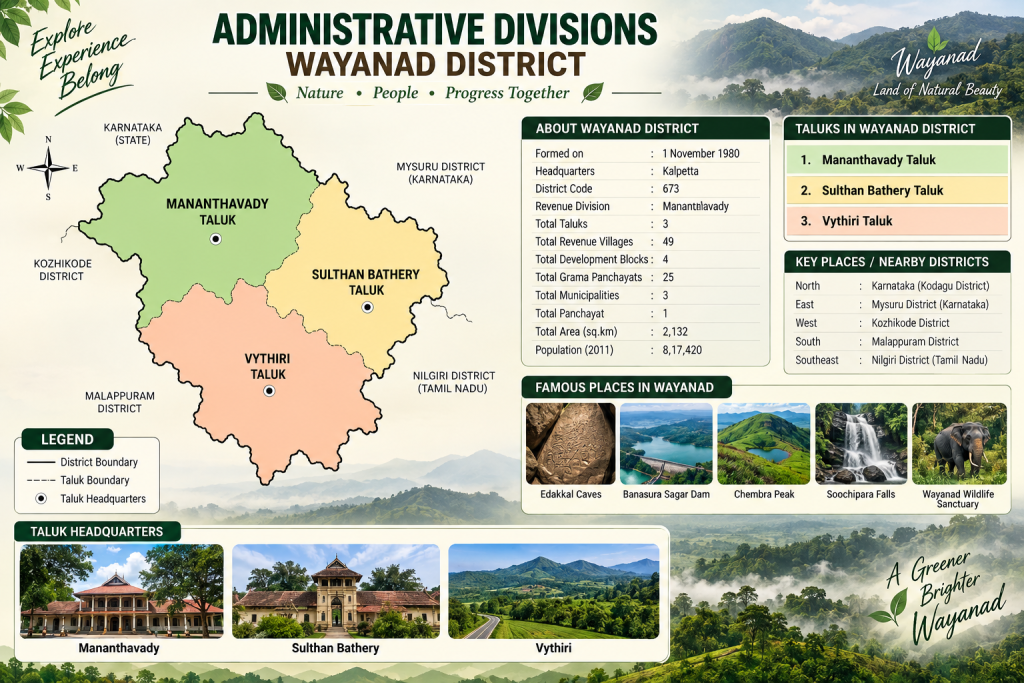
Wayanad District is administratively organized into 3 Revenue Divisions, 3 Taluks and 4 Blocks, which help in the effective management and delivery of government services to the people. The district administration functions through the District Collectorate, supported by revenue, rural development and local administrative authorities. The major Revenue Divisions are Mananthavady, Sulthan Bathery and Vythiri, with Mananthavady, Sulthan Bathery and Vythiri serving as the respective Taluk headquarters. The district has important urban and rural administrative centres, with Kalpetta serving as the district headquarters. The Block Development Offices and Grama Panchayats play an important role in implementing rural development programmes, while municipalities and town panchayats manage urban civic services. These administrative divisions ensure efficient governance, public service delivery and development across the district. They also support the implementation of welfare schemes, infrastructure projects, agricultural programmes, education, healthcare and disaster-management activities.
Revenue Administration
Wayanad District’s Revenue Administration is responsible for land administration, revenue collection, maintenance of land records, issuance of revenue certificates, public grievance redressal and implementation of various government schemes and services. The district has 3 Revenue Divisions, 3 Revenue Taluks, 18 Revenue Villages and 49 Village Offices, which support effective administration at the local level. The District Collector oversees revenue-related activities, while Revenue Divisional Officers, Tahsildars and Village Officers manage division-, taluk- and village-level administration. The department handles important services such as Patta and land-record matters, mutation, possession certificates, income and community certificates, land surveys, encroachment issues, disaster management and relief activities, ensuring efficient revenue management and accessible government services to citizens. The administration also supports land acquisition, rehabilitation, emergency relief, maintenance of government properties and coordination during natural disasters. efficiently.